I just thought I'd show how sweet the mount for the Garmin eTrex 20 is when my fairing is installed. I just moved it to this position after missing turns on my last ride. Before I had the Garmin eTrex co-located with the heart rate monitor on the left. In this position it is right in my line of sight and if the sun light is right or back lighting is on, I shouldn't blow past any more turns.
I'm using a RAM mount for the eTrex. I've used these mounts on motorcycles(staring back when the Garmin III+ was bleeding edge tech) and boats. They are a little heavier and probably more expensive than some others but in literally hundreds of thousands of miles traveled by MC and boat they have never failed.
This fairing mount is pretty handy. I think I may use the end to mount a new mirror. Also if weather gets really sweltering the clear plexiglass comes off easily by removing the 4 screws with knurled heads.
We left standard bikes and have never looked back! Here are some of our travels and travails over several thousand miles of riding recumbent trikes
Monday, March 26, 2012
Saturday, March 24, 2012
Using the Garmin eTrex 20 GPS.
The last several days gave me some invaluable experience using the Garmin eTrex 20. We have the complete set of ACA maps needed but my plan is to let my wife have those while I used downloaded routes on the eTrex 20. Inital thoughts.
This has been a trail and error approach. I've blown past turns and not noticed until miles later. This happened when following US1 near Damarscotta, the track was through town I stayed on US 1. The route did reenter US 1 so no real harm, this time.
Also viewing the eTrex is difficult when the sun is not behind. And for me the magenta track/route color on the GPS is hard to see with sunglasses on. So it would be nice to have routing where it would at least beep when a waypoint is reached.
But even with all these issues it's still better than using paper maps IMO. And without back lighting the battery run time easily covers a few days of riding. I think I'll do a test with the back lighting on constantly to get an idea of how many hours a day it can be safely used.
- The ACA GPX waypoint files may not be completely up to date. The NTR section 11 map 152 routes from Belfast ME to Camden ME via RT 52. The GPX files route via US 1.
- Garmin BaseCamp program has a distinctly 1990's feel to it. www.RideWithGPS.com has a free and much better interface IMO.
- Garmin BaseCamp has a "Bicycling" activity setting but I don't know what the point is since CityNavigator knows zero about bike paths and will go to crazy routing to get around them.
 |
| This is the crazy route around the Brunswick Androscoggin River Bike Path. F0B7M0 is the start of the path that then follows the river past the Rt 196 bridge |
- The workaround I found was to make a route on on RideWithGPS, download as GPX file. Up load this file to BaseCamp. It is then viewed as a track and will follow the bike path. I did try to convert the track to a route but the same garbage happened. So I just uploaded the track and told the eTrex20 to follow the track. The problem is the eTrex will not "navigate" and give turn data and the like when using tracks. So when entering the route in RideWithGPS I made sure to put waypoints near any turn. Then on the GPS I set one data field to "Distance to Next". And voila, I know when my next turn is coming up:)
 |
| This is the tracks file of the above route. This is then uploaded to the eTrex 20. |
This has been a trail and error approach. I've blown past turns and not noticed until miles later. This happened when following US1 near Damarscotta, the track was through town I stayed on US 1. The route did reenter US 1 so no real harm, this time.
Also viewing the eTrex is difficult when the sun is not behind. And for me the magenta track/route color on the GPS is hard to see with sunglasses on. So it would be nice to have routing where it would at least beep when a waypoint is reached.
But even with all these issues it's still better than using paper maps IMO. And without back lighting the battery run time easily covers a few days of riding. I think I'll do a test with the back lighting on constantly to get an idea of how many hours a day it can be safely used.
Thursday, March 22, 2012
Waldoboro to Durham
Day 3 - In the "Big City" now. Well what passes for cities in Maine, Bath and Brunswick. Real traffic but drivers still being good. The last 10miles was character building along with summer time temps. First breakage, mirror snapped off. I think hitting an old wood bridge at speed did it, frankly I'm surprised nothing else came loose.
I've found that climbing hills I use the heart rate monitor kinda like a temperature gauge in a car. I keep an eye on it and can spin with with abandon until 153. Then slow down to keep it steady. If need I can still sprint until I hit about 170 but then I make sure to slow/stop to let the rate to drop back to the 130's
 |
| Nice rest stop in Damariscotta Maine |
 |
| Brunswick bike path wasn't too scenic but better than being on the road. |
 |
| Lost mirror and heart rate monitor. |
Wednesday, March 21, 2012
Belfast to Waldoboro
Today I started at the Belfast foot bridge and pointed my trike toward Waldoboro via Camden. Following the ACA route I left Belfast on Rt 52 to Lincolnville Center. This is a two lane hilly road without a paved shoulder. But this early in the season without any tourists all the car drivers were very courteous. Sometimes while going slow on ascents I'd pull in to the gravel shoulder to let cars pass. I'd hate to do this road in the summer however with the not so nice out of state cars. The welcomed shoulders came back near Megunticook Lake and had shoulders on the main roads all the way to Waldoboro.
In Camden I deviated from the ACA route staying away from the cold air coming off the water. But by late day I was ready to be cooled off. Who would have thought HEAT (80F+) would be an issue in Maine in March. Rt 90 and US1 had much more traffic but with generally good shoulders it wasn't an issue.
 |
| Leaving Belfast behind, nice wake-up climb. |
 |
| First Moose sighting:) |
 |
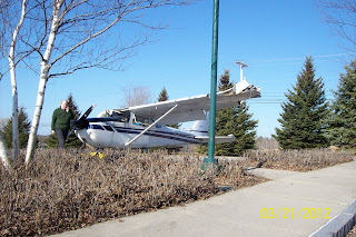
| Guess what this is part of............. |
 |
| It belongs to a small plane that just missed the airport. |
 |
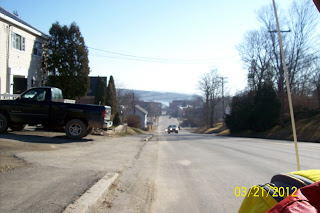
| No shoulder on RT 52 |
 |
| Glad I have three wheels dealing with this. |
 |
| Great long views nearing Lincolnville. |
 |
| Not much in Lincolnville Center. 2 cars passed during 10 minute break. |
 |
| Cold air coming off the lake. |
 |
| And real shoulders again nearing Camden, yeah! |
Tuesday, March 20, 2012
Knox(home) to Belfast Maine
MapMyRide link Today was such a beautiful day I decided to start my across the USA ride. About 9 am I left the house and about two miles down the road I had my first "chased by a dog" event while the fat idiot owner in a tie dyed shirt looked on. But the dog must have experience with pepper spray, and an extended arm pointed at the dog and it backed off. From now on I'm keeping the pepper spray closer at hand.
Some nice climbs but in general a drop from about 750ft msl at our house to sea level in Belfast. Nice low traffic roads or nice shoulders so I never felt in danger. Arrived at the foot bridge before noon and called Donna for a pick-up. Only 17-18 miles since this was originally only a training ride. But once home and looking at the great weather predicted for the next few days, we decided to start the ride until SAG distance back home is too long then we'll do a weather hold until late April. I can't believe this weather will hold.
Some nice climbs but in general a drop from about 750ft msl at our house to sea level in Belfast. Nice low traffic roads or nice shoulders so I never felt in danger. Arrived at the foot bridge before noon and called Donna for a pick-up. Only 17-18 miles since this was originally only a training ride. But once home and looking at the great weather predicted for the next few days, we decided to start the ride until SAG distance back home is too long then we'll do a weather hold until late April. I can't believe this weather will hold.
 |
| Pepper spay kept in hand after dog event. |
 |
| Horses were curious about my trike |
 |
| Another day of great descents!!!! |
 |
| Belfast foot bridge, nice descent but dicey roll out. |
 |
| Belfast Harbor |
 |
| Home of Idiot dog owner, with dog on porch. |
Monday, March 19, 2012
Back to "Real" training
We're back home in Maine and the weather is fine! 70 degF and low humidity, how much better can it get! So there is no excuse to ride the boring ride of the SportCrafters trainer looking out the living room window. To get back up to speed on hills I've been just riding about 2.5 miles out from the house to where the road shoulder ends then coming home. Our home is on a pretty tall hill, in fact the only passing lane on Rt 137 between Belfast and Waterville is on our hill. Not trying to brag just saying that a good workout can be had in under 10 miles of riding around here. Naturally to ride the NTR I'll need to be up to riding 60 miles in this terrain.
 |
| Nice wide shoulders sometimes. |
 |
| Just rolling hills approaching home. |
 |
| The cut in the tree line is where the road goes by our house |
 |
| A road I like riding last year. This is a paved road, but I have no idea when it might get cleaned of all this crud. |
 |
| Shoulder get narrower. |
 |
| Don't know why but this sign always cracks me up |
 |
| Pictures just don't do this hill justice. |
 |
| And home, I walk the trike on this last hill, no traction. |
Subscribe to:
Comments (Atom)

